A big part of farming? Planning for upcoming projects. On my Texas farm, I know that an upcoming project for late winter to early spring is going to be improving drainage for a field I just can’t work after a heavy rain.
The first step: finding the fall of the land in question. While the field in front of my house does appear to be flat, I do struggle to keep it drained. And with a wetland situated on the far end of the field, ideally water would drain from the land into the pond.
Laser Level
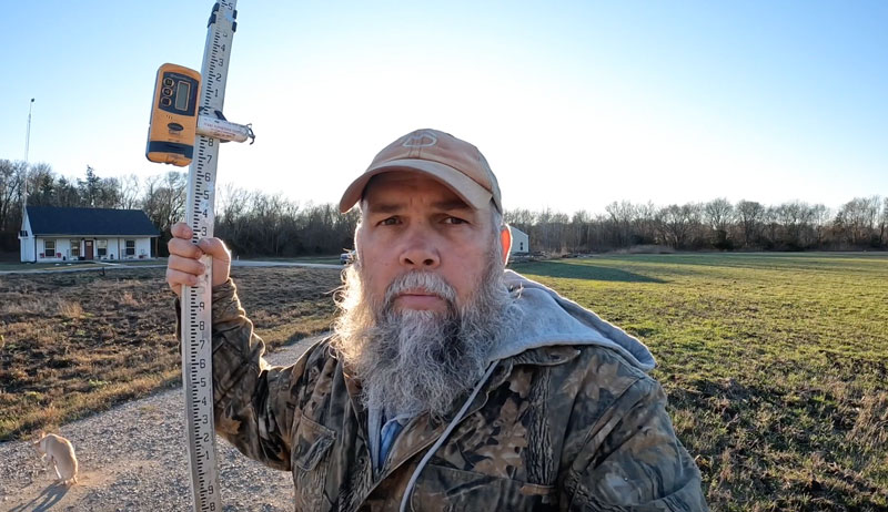
In order to determine the fall of my field, I’m going to use a laser level, shown in the video above. Some people call these a “transit,” but that’s not exactly what this is. Rather, it’s a laser plane that shoots a laser across the field, which we can measure at certain points to determine if the land rises or falls.
It’s important to set up the laser plane on a tripod and make sure it, itself, is level. This takes a bit of practice, but the bubble level built in to the machine does help.
Read more: You should check land drainage before planting new trees.
First Reading
I personally like to start at the high ground and work downwards, but that’s just me. I found the area I’d like to see downhill drainage in and took my first reading there. When I intercept the laser, I hear a noise that confirms my place on level ground. This allows me to set my reference point.
When I move downhill, though, I find that when I intercept the laser, I hear no sound. Lifting the device, however, I eventually hear a beeping sound, telling me I’m on lower ground.
If moving the device lower on the stick initiates the sound, though, I’ll know I’m on lower ground. That’s a little more labor intensive, though, which is why I like to start on the high ground.
Check out the video above to see what I do next, what the project tells me and how I can use the measurements I collect.